Terrestrial LiDAR Remote Sensing in 2025: Transforming Geospatial Intelligence and Industry Applications. Explore the Next Wave of High-Resolution Mapping, Market Expansion, and Technological Breakthroughs.
- Executive Summary: Key Trends and Market Drivers in 2025
- Market Size and Growth Forecast (2025–2029): CAGR and Revenue Projections
- Technological Innovations: Advances in LiDAR Sensors and Data Processing
- Major Industry Players and Strategic Partnerships
- Emerging Applications: From Forestry to Smart Infrastructure
- Regulatory Landscape and Industry Standards (e.g., ieee.org, usgs.gov)
- Regional Analysis: North America, Europe, Asia-Pacific, and Beyond
- Challenges: Data Management, Cost, and Integration Barriers
- Sustainability and Environmental Impact of Terrestrial LiDAR
- Future Outlook: Disruptive Trends and Opportunities Through 2029
- Sources & References
Executive Summary: Key Trends and Market Drivers in 2025
The terrestrial LiDAR remote sensing sector is poised for significant growth and transformation in 2025, driven by rapid technological advancements, expanding application domains, and increasing demand for high-resolution geospatial data. Terrestrial LiDAR (Light Detection and Ranging) systems, which utilize laser pulses to generate precise three-dimensional representations of environments, are becoming indispensable tools across industries such as construction, forestry, mining, urban planning, and infrastructure monitoring.
A key trend in 2025 is the continued miniaturization and integration of LiDAR sensors, enabling more portable and user-friendly terrestrial systems. Leading manufacturers such as Leica Geosystems and RIEGL are introducing new models with enhanced range, accuracy, and real-time data processing capabilities. These innovations are reducing operational costs and making high-precision scanning accessible to a broader range of users, from large engineering firms to small surveying teams.
Automation and artificial intelligence (AI) are also reshaping the terrestrial LiDAR landscape. Advanced software solutions now offer automated feature extraction, object recognition, and change detection, significantly accelerating data analysis workflows. Companies like FARO Technologies and Topcon Positioning Systems are investing in cloud-based platforms and AI-driven analytics, allowing users to process and share massive point cloud datasets efficiently and securely.
Another major driver is the integration of terrestrial LiDAR with other geospatial technologies, such as photogrammetry, GNSS, and unmanned systems. This convergence is enabling comprehensive digital twins and smart city applications, supporting infrastructure resilience, asset management, and environmental monitoring. For example, Hexagon AB is leveraging its broad portfolio to deliver end-to-end solutions that combine terrestrial LiDAR with advanced visualization and simulation tools.
Sustainability and regulatory compliance are further influencing market dynamics. Governments and industry bodies are increasingly mandating detailed spatial documentation for construction, heritage preservation, and disaster risk reduction. The ability of terrestrial LiDAR to provide rapid, non-invasive, and highly accurate measurements is making it a preferred choice for meeting these requirements.
Looking ahead, the terrestrial LiDAR market in 2025 and beyond is expected to benefit from ongoing R&D, falling hardware costs, and expanding interoperability standards. As digital transformation accelerates across sectors, terrestrial LiDAR remote sensing will remain a cornerstone technology for spatial intelligence, driving innovation and operational efficiency worldwide.
Market Size and Growth Forecast (2025–2029): CAGR and Revenue Projections
The terrestrial LiDAR remote sensing market is poised for robust growth between 2025 and 2029, driven by expanding applications in infrastructure, forestry, mining, and urban planning. As of 2025, the market is characterized by increasing adoption of high-precision 3D mapping technologies, with terrestrial LiDAR systems offering unparalleled spatial resolution and accuracy for ground-based surveys. Key industry players, including Hexagon AB (through its Leica Geosystems division), Trimble Inc., and Topcon Corporation, continue to innovate in sensor hardware, software integration, and workflow automation, fueling market expansion.
Current industry data and company reports indicate that the global terrestrial LiDAR market is expected to achieve a compound annual growth rate (CAGR) in the range of 10–13% from 2025 to 2029. This growth is underpinned by rising demand for digital twins, smart city initiatives, and the need for efficient asset management in sectors such as transportation and utilities. For example, Hexagon AB has reported increased deployment of its Leica ScanStation series for large-scale infrastructure and construction projects, while Trimble Inc. continues to expand its portfolio with integrated terrestrial LiDAR solutions tailored for geospatial professionals and civil engineers.
Revenue projections for the terrestrial LiDAR segment suggest that global market value could surpass USD 1.5 billion by 2029, up from an estimated USD 900 million in 2025. This trajectory is supported by ongoing investments in R&D, the introduction of more compact and cost-effective LiDAR units, and the integration of artificial intelligence for automated feature extraction and data processing. Topcon Corporation and RIEGL Laser Measurement Systems are notable for their advancements in high-speed, high-density scanning systems, which are increasingly adopted for both static and mobile terrestrial applications.
Looking ahead, the terrestrial LiDAR market is expected to benefit from regulatory support for digital infrastructure and sustainability initiatives, particularly in Europe, North America, and parts of Asia-Pacific. Industry collaborations and partnerships with public agencies are anticipated to further accelerate adoption. As the technology matures, the market will likely see a shift toward subscription-based software and data analytics services, complementing hardware sales and expanding recurring revenue streams for leading manufacturers and solution providers.
Technological Innovations: Advances in LiDAR Sensors and Data Processing
The field of terrestrial LiDAR remote sensing is experiencing rapid technological innovation, particularly in sensor hardware and data processing capabilities. As of 2025, manufacturers are introducing new generations of terrestrial laser scanners that offer higher accuracy, faster acquisition rates, and improved portability. For example, leading companies such as Leica Geosystems and RIEGL have released advanced terrestrial LiDAR systems featuring multi-echo and waveform digitization technologies, which enhance the ability to capture complex surface geometries and vegetation structures. These systems now routinely achieve millimeter-level precision and can collect millions of points per second, significantly reducing field time and increasing data density.
A notable trend is the miniaturization and integration of LiDAR sensors with other geospatial technologies. Compact, lightweight terrestrial scanners are being developed for easier deployment in challenging environments, including forested and urban areas. FARO Technologies has introduced portable terrestrial LiDAR units that can be operated by a single user, while maintaining high-resolution data capture. Additionally, sensor fusion—combining LiDAR with photogrammetry, GNSS, and IMU systems—is becoming standard, enabling more accurate georeferencing and richer datasets.
On the data processing front, advances in artificial intelligence and cloud computing are transforming how LiDAR data is managed and analyzed. Automated feature extraction, object classification, and change detection algorithms are now being integrated into commercial software platforms. Companies like Hexagon (parent of Leica Geosystems) and Topcon Positioning Systems are investing in cloud-based solutions that allow users to process and share large point cloud datasets remotely, facilitating collaboration and reducing the need for high-end local computing resources.
Looking ahead, the next few years are expected to bring further improvements in sensor efficiency, with a focus on reducing power consumption and increasing real-time processing capabilities. The integration of machine learning for automated interpretation of terrestrial LiDAR data is anticipated to accelerate, supporting applications in forestry, construction, and infrastructure monitoring. Industry leaders are also working on interoperability standards to ensure seamless data exchange between different hardware and software ecosystems, a move supported by organizations such as Open Geospatial Consortium.
In summary, terrestrial LiDAR remote sensing in 2025 is characterized by rapid sensor innovation, smarter data processing, and growing ecosystem integration, setting the stage for broader adoption and new application domains in the coming years.
Major Industry Players and Strategic Partnerships
The terrestrial LiDAR remote sensing sector in 2025 is characterized by a dynamic landscape of established manufacturers, innovative startups, and strategic collaborations aimed at advancing sensor technology, data processing, and application integration. The industry is led by a handful of major players, each contributing to the evolution of terrestrial LiDAR through hardware development, software solutions, and end-to-end service offerings.
Among the most prominent companies, Leica Geosystems (part of Hexagon AB) continues to set benchmarks with its high-precision terrestrial laser scanners, such as the Leica RTC360 and ScanStation series. These systems are widely adopted in surveying, construction, and infrastructure monitoring. RIEGL, an Austrian manufacturer, is recognized for its robust and versatile terrestrial LiDAR instruments, including the VZ-series, which are deployed globally for applications ranging from forestry to mining. Topcon Positioning Systems and Trimble are also key players, offering integrated solutions that combine terrestrial LiDAR with GNSS and photogrammetry for comprehensive geospatial workflows.
Strategic partnerships are increasingly shaping the industry’s trajectory. In recent years, collaborations between hardware manufacturers and software developers have accelerated the adoption of artificial intelligence and cloud-based processing in LiDAR workflows. For example, Leica Geosystems has partnered with various software providers to enhance point cloud analytics and automate feature extraction, while RIEGL has engaged in joint ventures to integrate its sensors with autonomous mobile platforms for industrial and environmental monitoring.
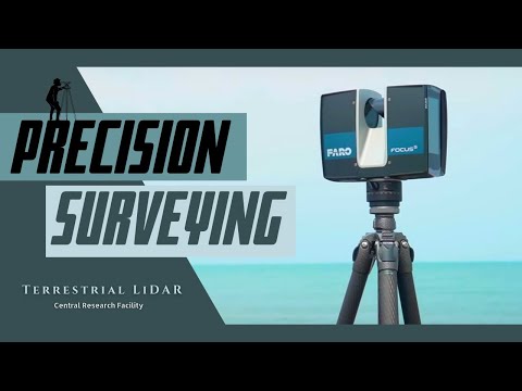
Emerging players are also making significant inroads. Companies such as FARO Technologies are expanding their terrestrial LiDAR portfolios with compact, user-friendly scanners targeting new markets like facility management and digital twin creation. Meanwhile, GeoSLAM is gaining traction with its mobile mapping solutions that complement static terrestrial LiDAR, enabling rapid data capture in complex environments.
Looking ahead, the next few years are expected to see further consolidation and cross-sector partnerships, particularly as terrestrial LiDAR becomes integral to smart city initiatives, autonomous vehicle infrastructure, and climate resilience projects. Industry leaders are investing in interoperability standards and open data platforms to facilitate broader adoption and integration with other geospatial technologies. As the market matures, collaborations between sensor manufacturers, software developers, and end-users will be pivotal in unlocking new applications and driving innovation in terrestrial LiDAR remote sensing.
Emerging Applications: From Forestry to Smart Infrastructure
Terrestrial LiDAR remote sensing is rapidly expanding its footprint across diverse sectors, with 2025 marking a pivotal year for both technological advancement and application breadth. Traditionally dominant in forestry, terrestrial LiDAR is now integral to smart infrastructure, urban planning, and environmental monitoring, driven by improvements in sensor accuracy, portability, and data processing capabilities.
In forestry, terrestrial LiDAR continues to revolutionize forest inventory and ecosystem monitoring. The technology enables precise measurement of tree height, diameter, and canopy structure, supporting sustainable forest management and carbon stock assessments. Companies such as RIEGL and Leica Geosystems are at the forefront, offering high-resolution terrestrial laser scanners that facilitate rapid, non-destructive data collection. These systems are increasingly deployed in large-scale forest health monitoring projects, with integration into national and international carbon accounting frameworks expected to accelerate through 2025 and beyond.
Urban environments are witnessing a surge in terrestrial LiDAR adoption for smart infrastructure development. The technology is being used to create detailed 3D models of buildings, roads, and utilities, enabling more efficient asset management, maintenance planning, and disaster resilience. Topcon Positioning Systems and FARO Technologies are notable providers, supplying terrestrial LiDAR solutions tailored for construction, civil engineering, and facility management. In 2025, cities are increasingly leveraging these datasets to support digital twin initiatives, where real-time LiDAR data feeds into dynamic models for urban planning and operational optimization.
Emerging applications are also evident in transportation and critical infrastructure. Railways, bridges, and tunnels are being routinely scanned to detect structural deformations, monitor clearances, and ensure safety compliance. Hexagon AB, through its Geosystems division, is actively developing integrated LiDAR platforms that combine terrestrial and mobile mapping for comprehensive infrastructure assessment. The convergence of terrestrial LiDAR with AI-driven analytics is expected to further automate anomaly detection and predictive maintenance in the coming years.
Looking ahead, the outlook for terrestrial LiDAR remote sensing is robust. Sensor miniaturization, enhanced range, and real-time data processing are lowering barriers to entry and expanding use cases. The integration of terrestrial LiDAR with other geospatial technologies—such as UAVs, GNSS, and IoT networks—will drive new applications in precision agriculture, mining, and environmental hazard monitoring. As industry standards evolve and interoperability improves, terrestrial LiDAR is poised to become a foundational tool for digital transformation across both natural and built environments.
Regulatory Landscape and Industry Standards (e.g., ieee.org, usgs.gov)
The regulatory landscape and industry standards for terrestrial LiDAR remote sensing are evolving rapidly as the technology matures and its applications expand across sectors such as infrastructure, forestry, mining, and urban planning. In 2025, regulatory frameworks are increasingly focused on ensuring data quality, interoperability, and safety, while also addressing privacy and ethical considerations associated with high-resolution spatial data collection.
A cornerstone of standardization in LiDAR technology is the work of the IEEE, which has developed and continues to update standards such as IEEE 1873-2019 for 3D LiDAR sensor performance. These standards provide guidelines for system characterization, calibration, and data formatting, facilitating interoperability between different hardware and software platforms. The IEEE is expected to release further updates and potentially new standards in the coming years, reflecting advances in sensor capabilities and data processing algorithms.
In the United States, the U.S. Geological Survey (USGS) plays a pivotal role in setting specifications for terrestrial LiDAR data, particularly through its 3D Elevation Program (3DEP). The USGS LiDAR Base Specification (currently version 2.1) defines requirements for data accuracy, point density, and metadata, serving as a benchmark for federal, state, and commercial projects. Ongoing stakeholder engagement suggests that updates to these specifications are likely in the near future to accommodate higher-density sensors and new use cases such as urban digital twins and climate resilience planning.
Internationally, organizations such as the International Organization for Standardization (ISO) are also active in developing standards for geospatial data, including those relevant to LiDAR. ISO/TC 211, for example, addresses geographic information/geomatics, and its standards are increasingly referenced in cross-border projects and by multinational companies.
Industry consortia and manufacturers are contributing to the standardization process as well. Leading LiDAR system providers like Leica Geosystems and RIEGL are involved in collaborative efforts to harmonize data formats (e.g., LAS/LAZ), promote open APIs, and ensure compatibility with major GIS and CAD platforms. These companies also provide compliance documentation and support for meeting regulatory requirements in various jurisdictions.
Looking ahead, the regulatory environment is expected to place greater emphasis on data security, privacy, and ethical use, especially as terrestrial LiDAR is increasingly deployed in populated areas and for critical infrastructure monitoring. Stakeholders should anticipate more rigorous certification processes and expanded guidance from both governmental and industry bodies, ensuring that terrestrial LiDAR remote sensing continues to deliver reliable, standardized, and responsible data products.
Regional Analysis: North America, Europe, Asia-Pacific, and Beyond
The terrestrial LiDAR remote sensing market is experiencing dynamic growth and technological advancement across key global regions, notably North America, Europe, and Asia-Pacific, with emerging activity in other territories. As of 2025, these regions are characterized by distinct drivers, adoption patterns, and strategic initiatives shaping the sector’s outlook.
North America remains a global leader in terrestrial LiDAR deployment, propelled by robust investments in infrastructure, forestry, and autonomous vehicle research. The United States, in particular, benefits from a strong ecosystem of LiDAR manufacturers and integrators. Companies such as Velodyne Lidar and GeoSLAM (with a significant presence in both the US and UK) are at the forefront, offering high-precision terrestrial LiDAR systems for applications ranging from urban mapping to mining. The region’s regulatory environment and public-private partnerships continue to foster innovation, with increasing adoption in smart city projects and environmental monitoring.
Europe is marked by a focus on sustainable development and heritage conservation, driving demand for terrestrial LiDAR in urban planning, cultural heritage documentation, and environmental assessment. Germany, the UK, and France are notable hubs, with companies like RIEGL (Austria) and Leica Geosystems (Switzerland) leading in hardware and software solutions. The European Union’s emphasis on digital infrastructure and climate resilience is expected to further accelerate LiDAR adoption through 2025 and beyond, particularly in large-scale infrastructure and reforestation projects.
Asia-Pacific is witnessing rapid expansion, underpinned by large-scale infrastructure development and smart city initiatives in China, Japan, South Korea, and Australia. Chinese manufacturers such as RoboSense and Hesai Technology are gaining global traction, offering cost-competitive terrestrial LiDAR systems and driving down barriers to entry. Regional governments are increasingly integrating LiDAR into disaster management, urban planning, and transportation safety, with significant investments anticipated through 2027.
Beyond these core regions, adoption is emerging in Latin America, the Middle East, and Africa, albeit at a slower pace. These markets are primarily driven by infrastructure modernization and natural resource management, with international suppliers and local integrators collaborating to introduce terrestrial LiDAR solutions.
Looking ahead, the global terrestrial LiDAR remote sensing landscape is expected to be shaped by continued hardware miniaturization, improved data processing capabilities, and expanding application domains. Strategic partnerships between regional technology leaders and end-users will likely accelerate market penetration and innovation across all continents.
Challenges: Data Management, Cost, and Integration Barriers
The rapid adoption of terrestrial LiDAR remote sensing in 2025 is accompanied by significant challenges related to data management, cost, and integration barriers. As LiDAR sensors become more advanced and accessible, the volume and complexity of point cloud data generated have increased exponentially. Managing, storing, and processing these massive datasets requires robust IT infrastructure and specialized software, which can be a limiting factor for many organizations. Leading LiDAR manufacturers such as Leica Geosystems and RIEGL have responded by developing proprietary software suites and cloud-based solutions, but interoperability between different platforms and data formats remains a persistent issue.
Cost is another major barrier. While the price of LiDAR hardware has decreased over the past decade, high-precision terrestrial systems from companies like FARO Technologies and Topcon Positioning Systems still represent a significant capital investment. Additionally, operational costs—including field deployment, data processing, and skilled personnel—can be prohibitive for smaller organizations or research groups. Some manufacturers are addressing this by offering rental models or service-based solutions, but the overall cost structure remains a challenge for widespread adoption.
Integration with existing geospatial workflows and legacy data is also a significant hurdle. Many organizations rely on established GIS and CAD systems, and incorporating high-density LiDAR data often requires substantial workflow adjustments and staff retraining. Industry leaders such as Trimble and Hexagon AB are investing in software interoperability and open data standards, but seamless integration is not yet universal. The lack of standardized data formats and metadata conventions can lead to inefficiencies and data silos, particularly in multi-vendor environments.
Looking ahead, the sector is expected to see incremental improvements in data compression, automated feature extraction, and cloud-based processing, which may alleviate some data management burdens. Industry consortia and standards bodies, such as the American Society for Photogrammetry and Remote Sensing (ASPRS), are actively working on guidelines to improve data interoperability and quality assurance. However, until these solutions are widely adopted, data management, cost, and integration barriers will continue to shape the pace and scale of terrestrial LiDAR remote sensing deployment through 2025 and the following years.
Sustainability and Environmental Impact of Terrestrial LiDAR
Terrestrial LiDAR remote sensing is increasingly recognized for its contributions to sustainability and environmental monitoring, particularly as the technology matures and becomes more accessible in 2025 and the coming years. LiDAR (Light Detection and Ranging) systems, which use laser pulses to generate high-resolution three-dimensional data, are now widely deployed for applications such as forest inventory, carbon stock assessment, habitat mapping, and landform change detection. These applications are critical for supporting global sustainability goals, including climate change mitigation and biodiversity conservation.
One of the most significant environmental benefits of terrestrial LiDAR is its ability to provide accurate, repeatable, and non-destructive measurements of vegetation structure and biomass. This capability is essential for monitoring forest health, quantifying carbon sequestration, and informing reforestation or conservation strategies. For example, terrestrial LiDAR is used by forestry organizations and research institutions to assess tree growth, species composition, and canopy structure with unprecedented detail, reducing the need for manual sampling and minimizing disturbance to sensitive ecosystems.
In 2025, leading LiDAR manufacturers such as Leica Geosystems, RIEGL, and Topcon Positioning Systems are advancing the sustainability profile of their terrestrial LiDAR solutions. These companies are focusing on energy-efficient hardware, longer-lasting components, and modular systems that reduce electronic waste. For instance, Leica Geosystems emphasizes the durability and upgradability of its laser scanners, which extends product lifecycles and reduces the environmental footprint associated with frequent equipment replacement.
Furthermore, terrestrial LiDAR data is increasingly integrated with other remote sensing technologies and open data platforms, enabling more comprehensive environmental assessments and collaborative research. Organizations such as the United States Geological Survey (USGS) and NASA are incorporating terrestrial LiDAR datasets into broader geospatial frameworks to support land management, disaster response, and climate science. This integration enhances the value of LiDAR data for sustainability by facilitating large-scale, data-driven decision-making.
Looking ahead, the environmental impact of terrestrial LiDAR is expected to further decrease as manufacturers adopt greener production practices and as the industry shifts toward cloud-based data processing, which can optimize energy use and reduce the need for physical data storage. Additionally, the proliferation of lightweight, portable LiDAR units is making it easier for field teams to access remote or sensitive areas with minimal ecological disturbance. As regulatory and market pressures for sustainable technology intensify, terrestrial LiDAR is poised to play an even greater role in supporting environmental stewardship and sustainable land management through 2025 and beyond.
Future Outlook: Disruptive Trends and Opportunities Through 2029
The terrestrial LiDAR remote sensing sector is poised for significant transformation through 2029, driven by rapid technological advancements, expanding application domains, and evolving industry standards. As of 2025, the market is witnessing a shift toward more compact, energy-efficient, and higher-resolution LiDAR systems, with leading manufacturers such as Leica Geosystems, RIEGL, and Topcon Positioning Systems introducing new platforms that emphasize portability and automation. These innovations are enabling broader deployment in fields such as forestry, urban planning, mining, and infrastructure monitoring.
A key disruptive trend is the integration of artificial intelligence (AI) and machine learning algorithms with terrestrial LiDAR data processing. This fusion is expected to dramatically accelerate data interpretation, automate feature extraction, and enhance the accuracy of 3D modeling. Companies like Hexagon AB (parent of Leica Geosystems) are investing in software ecosystems that streamline workflows from data acquisition to actionable insights, reducing the need for manual intervention and specialized expertise.
Another major development is the convergence of terrestrial LiDAR with other geospatial technologies, such as photogrammetry, ground-penetrating radar, and GNSS. This multi-sensor approach is being championed by industry leaders including Trimble Inc., who are developing integrated platforms that deliver richer, more comprehensive datasets for complex environments. The result is improved accuracy in applications ranging from construction site monitoring to environmental change detection.
The democratization of LiDAR technology is also underway, with the emergence of more affordable and user-friendly systems. Manufacturers are responding to demand from smaller engineering firms, academic institutions, and even citizen scientists by offering entry-level terrestrial LiDAR units with simplified interfaces and cloud-based data management. This trend is expected to broaden the user base and stimulate innovation in niche applications.
Looking ahead to 2029, the terrestrial LiDAR market is likely to see further disruption from advances in sensor miniaturization, battery technology, and real-time data transmission. The adoption of 5G and edge computing will facilitate near-instantaneous data sharing and processing, supporting time-sensitive applications such as disaster response and autonomous vehicle navigation. Industry bodies such as the U.S. Geological Survey are expected to play a pivotal role in setting standards and promoting interoperability, ensuring that the expanding ecosystem of terrestrial LiDAR solutions remains robust and reliable.
In summary, the next few years will be characterized by rapid innovation, increased accessibility, and deeper integration of terrestrial LiDAR with digital workflows, opening new opportunities across scientific, industrial, and public sectors.
Sources & References
- FARO Technologies
- Topcon Positioning Systems
- Hexagon AB
- Trimble Inc.
- Topcon Corporation
- Open Geospatial Consortium
- GeoSLAM
- IEEE
- International Organization for Standardization (ISO)
- Velodyne Lidar
- GeoSLAM
- RoboSense
- American Society for Photogrammetry and Remote Sensing (ASPRS)
- NASA